Special thanks go to the following elected officials and appointed officials whose assistance was vital
during the preparation of the Plan.
| Bunker Hill Town Council | |
| Fred Kemp, President | Member, At-Large |
| Marcia Worland | Member, Ward 1 |
| Jerry McDaniel | Member, Ward 2 |
| Clarence Gingerich | Member, Ward 3 |
| Norman McBride | Member, Ward 4 |
| Bunker Hill Plan Commission | |
| Leslie Briggs | President |
| Jerry Gable | Vice President |
| Clarence Gingerich | Town Council Representative |
| Steve Daniels | Member |
| Paul Irwin | Member |
| JoAnn Locke | Member |
| Lisa Taylor | Member |
| Sherry York | Member |
| Mike Zehring | Member |
| Linda Garber | Building Commissioner/Secretary |
| Bunker Hill Board of Zoning Appeals | |
| Carl Wade | Chairman |
| Mike Zehring | Vice Chairman |
| Linda Garber | Secretary |
| Mike Studebaker | Member |
| 1.1 What Is A Growth Management Plan? | ||
| 1.2 How To Use The Growth Management Plan | ||
| 1.3 Study Area | ||
| 1.4 Legal Authority | ||
| 2.1 Demographics | ||
| 2.2 Physical Inventory and Analysis | ||
| 2.3 Opportunities and Constraints | ||
| 3.1 Introduction | ||
| 3.2 Land Use Elements/Classifications | ||
| 3.3 Alternative Plans | ||
| 3.4 Goal Statements | ||
| 4.1 Introduction | ||
| 4.2 Land Use Classification | ||
| 4.3 Land Use Policies | ||
| 4.4 Future Land Use Plan | ||
CHAPTER ONE: INTRODUCTION
Significant economic, social, and physical pressures are being exerted on the Town of Bunker Hill,
Indiana and now is the time for Bunker Hill to begin building its tomorrow. A quick look at the facts
reveals the pressures that will continue in Bunker Hill:
| Since the last Miami County Master Plan Report was adopted in 1967, U.S. 31 has received increased commercialization and traffic growth; | |
| 2. | Due to its locational proximity to Grissom Aeroplex, Bunker Hill could realize an increasingly larger share of the region's growth and prosperity; and |
| 3. | Grissom Air Force Base has been decommissioned and the Grissom Redevelopment Authority is actively pursuing significant projects that will have county-wide economic development impacts. |
Management of this growth and the maintenance of Bunker Hill's quality of life must be pre-eminent goals for the Town's leaders, and a new Growth Management Plan for the Town is a logical starting point for this management and maintenance program. The next ten (10) years will be an extraordinary and exciting time in Bunker Hill.
1.1 What Is A Growth Management Plan?
The Growth Management Plan for Bunker Hill represents a coordinated and unified vision for the future development of the Town. The Plan is a document composed of several interrelated components, which when combined, produce a comprehensive guide and evaluation tool for Bunker Hill when it considers public and private land use decisions.
It is important to understand that this Plan should be viewed as a "framework" for future decisions. The
Plan does not just consist of a rendered map which indicates areas that should be commercial,
residential, industrial, etc. Instead, the Plan provides a detailed framework for making land use
decisions because:
| It is "long range" in that it projects physical development patterns to accommodate several years of economic growth; | |
| 2. | It is "comprehensive" since it is based on an analysis of a wide variety of man-made and natural factors; |
| 3. | It is "general" in that it forms a policy guide for future developments by proposing general rather than specific locations and sizes of elements; and |
| 4. | It permits the Town to relate specific projects, development proposals, and zoning matters to a coordinated program of development for Bunker Hill. |
In the end, the Growth Management Plan will serve as a guide and evaluation measure for the Town as it makes decisions which future generations will have to endure.
1.2 How To Use The Growth Management Plan
The planning process used to develop the Growth Management Plan was designed to provide the Town with a plan which assists in day-to-day decision making and also provides direction for the long range development of Bunker Hill. Through input at Plan Commission meetings, and review by Plan Commission members and Town Council members, areas of opportunities and constraints were identified. Goals have been developed which address the opportunities and constraints and reflect a common vision for the Town's future. The goals are accompanied by policies which define actions to be taken to achieve the Town's goals.
For example, when an application is made for a zoning change within the Town, the Growth Management Plan should be consulted to determine the application's compliance with the Town's long range goals and policies that affect the subject property. The applicant's property should be located on the Future Land Use Map to determine the policies initially applicable in reviewing the request. By utilizing this framework, the Plan begins to act as an evaluation tool for the Plan Commission and the Town Council. To this end, each proposal is afforded a fair and consistent method to be judged according to the individual merits of the proposal.
In addition to zoning decisions, coordination between the Town of Bunker Hill and other public and semi-public agencies can be facilitated through reference to the Growth Management Plan.
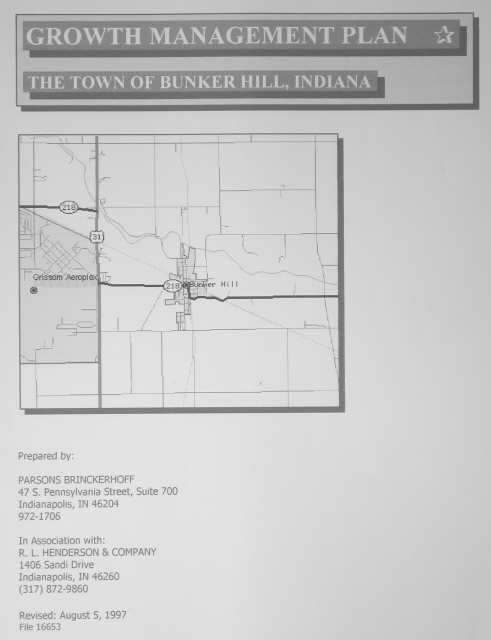
1.3 Study Area
The study area limits of the Growth Management Plan correspond to the corporate limits of Bunker Hill, Indiana. In addition, this Plan recognizes that future annexations are likely. Consequently, the study area also includes portions of Miami County that correspond to the two-mile jurisdiction limits beyond Bunker Hill's current municipal limits. This "outside" area is bound on the north by C.R. 500S, on the west by C.R, 400W, on the south by 1000S and on the east by Strawtown Pike.
1.4 Legal Authority
This Growth Management Plan is an element of Bunker Hill's Comprehensive Plan and is in compliance with Indiana Code which requires the Town's Plan Commission to develop a plan to guide the overall development of a municipal corporation.
CHAPTER TWO: LAND USE DEVELOPMENT CHARACTERISTICS
2.1 Demographics
A key component of any land use planning program is a thorough examination of the demographic trends and forecasts for the study area. Plans and policies must be based on realistic estimates of future residential and nonresidential growth.
Table 1 provides a summary look at the trends and forecasts for population growth in the study area (i.e.
Bunker Hill and the area westward to U.S. 31) over the period 1970 to 2010. The information presented
in Table 1 assumes the entire 1,700 acres in the western portion of the study area will be annexed by
Bunker Hill by the year 2010 and that a "balanced" distribution of land uses will be achieved.
| Table 1 Bunker Hill Population Trends and Projections |
|||||||
| Population | 956 | 984 | 1010 | 1024 | 1162 | 1437 | 1987 |
| Total Households | N/A | N/A | 391 | 397 | 423 | 523 | 723 |
| N/A | N/A | 3 | 3 | 3 | 3 | 3 | |
| Land Area (acres) | 217 | 217 | 217 | 246 | 446 | 946 | 1946 |
| Persons/Acre | 4.40 | 4.53 | 4.65 | 4.16 | 2.60 | 1.52 | 1.02 |
| Notes: | |||||||
|
|||||||
| Population: Since 1970, Bunker Hill has experienced growth, although at a very slow annual percentage rate. This annual percentage growth rate of 0.28% should be considered low when forecasting for the year 2000 and beyond due to the positive impacts occurring in the area (Grissom Redevelopment Authority, Corrections Facility, the efforts of the Peru/Miami County Economic Development Corporation, and the amount of potentially underdeveloped land in the study area). Consequently, the annual growth rates between 2000 and 2010 have been adjusted to reflect the study area's growth potential. | |
| 2. | Total Households and Persons/Households: The Town of Bunker Hill is following national trends with regard to household sizes. Bunker Hill should be expected to mirror this trend over the planning horizon. Over the years, the average number of persons per household has been remaining relatively stable. Reduced family sizes and increased non-married ownership of residential units account for this trend. It is interesting to note that according to the 1990 Census, Bunker Hill had 425 housing units. This ratio of units/households (425/391) creates an appropriate inventory for in-migration of new residents. |
| 3. | Land Area: Since 1990, Bunker Hill has annexed approximately 29 acres of land. The following table summarizes the past and projected land area. |
Annexed |
Acres/Year |
|
| 1970-1995 | 29 | 1.16 |
| 1995-2000 | 200 | 40 |
| 2000-2005 | 500 | 100 |
| 2005-2010 | 1000 | 200 |
| As shown, the Town could anticipate the annexation of approximately 1,700 acres over the next 12 years. The overriding issue regarding annexation is the Town's ability to provide water and sanitary sewer services required by the growth. The projections accelerate the Town's growth over the next 12 years. In light of the region's expanding economic development efforts and the success of the Grissom Redevelopment Authority, these projections, at this point in time, appear realistic. | |
| Persons/Acre: This information indicates a community's relative density. In 1970, the persons/acre of 4.4 was indicative of Bunker Hill's "compact" development pattern. The next decade reveals Bunker Hill's expansion into non-incorporated areas. |
2.2 Physical Inventory and Analysis
An assessment of the physical conditions of the study area is critical for a successful planning process. All communities must recognize "what they are" before they can possibly know "where they want to be." Data in this section presents an overview of the land uses, transportation systems, natural and man-made elements and community facilities in Bunker Hill and provides a framework for future planning issues.
2.2.1 Existing Land Uses: The planning team assembled extensive data on the generalized land uses
in Bunker Hill. The data was gathered by way of a "windshield survey" of the entire study area. Table 2
indicates the summary of existing land uses in the Town as of February 1997. Additionally, the table
compares these results to those found in the last land use inventory conducted in 1965.
| Table 2 Bunker Hill Existing Land Use Inventory |
||||
| Land Use Classification | Acreage | Percent of Total Acreage |
||
| Residential | 78 | 150.8 | 36 | 61 |
| Public/Semi-Public | 2 | 12.2 | 1 | 5 |
| Commercial/Business/Industrial | 8 | 6.0 | 4 | 2 |
| Vacant | 62 | 9.5 | 28 | 4 |
| Streets/Right-of-Way | 67 | 68.0 | 31 | 28 |
| TOTALS | 217 | 246.0 | 100 | 100 |
In addition to the land use classifications and their associated acreage identified above, the study area
also includes approximately 1,700 acres of "underdeveloped" land. This land area, if developed
appropriately, should offer the Town of Bunker Hill with the opportunity to "balance" its land use
patterns. Balanced land use patterns will create a balanced revenue stream to the Town. In other words,
the revenues generated by property taxes will meet or exceed the cost of public services. The map on
the following page illustrates Bunker Hill's Existing Land Uses.
In conclusion, this land use inventory, and the Existing Land Use Map, point out several issues to be
addressed:
| Residential land uses still dominate Bunker Hill's pattern of development. | |
| 2. | Vacant land has decreased significantly and positive economic development efforts will require annexation of underdeveloped land. |
| 3. | Commercial/Business/Industrial uses remain well under national averages. This land use classification will require attention in order for the Town to generate sufficient revenues to finance the Town's expansion. |
2.2.2 Existing Zoning: According to the Bunker Hill Zoning Ordinance, the Town is currently "divided" into 10 zoning districts. In addition, the Town also has a Plan Unit Development (PUD) Ordinance "to promote progressive development of land" and that the "PUD is a mixture of resident and business within the same area."
Figure 1: Existing Land Use Plan
With respect to future land use, a variety of comments, relating to zoning, are presented. These
comments may best be addressed by text amendments to the Zoning Ordinance and initiated by the
Town.
| Plan Unit Development Ordinance | ||
| Traffic Impact Studies should be required for all PUD's in excess of 20 acres or as deemed necessary by the Plan Commission. | ||
| B. | Site Plans should be based on contour intervals of one (1) foot, instead of the required two (2) feet. | |
| 2. | Zoning Ordinance | |
| A. | The Ordinance specifies minimum ground floor area requirements. Although this specification may present a logical and admirable step in providing compatibility between zoning districts, it also introduces a threatening, discriminatory effect in the Ordinance that Federal Courts have consistently ruled as objectionable and unconstitutional. | |
| B. | Analysis of the different zoning districts that allow for residential uses, indicates that some intermediate residential district(s) may be warranted, especially between the Al, R1 and R3 districts. The PUD Ordinance can help "fill the gap" but it should not be counted on to do so. Basically, there seems to be the need for residential districts that allow for smaller lot sizes than currently is allowed for in the Zoning Ordinance. Having districts that allow for flexibility will enhance the area's redevelopment efforts. There is nothing wrong with higher density residential development, if it is controlled and the municipality has land use policies to guide its development. | |
| C. | The section on Advertising Signs needs to be better defined especially in light of the potential of new commercial and business in the area between Bunker Hill and U.S. 31. Specifically, the section should better define the types of signs permitted and their sizes, etc. This way, the newly developed areas will not become "eyesores" to Bunker Hill's entryways. | |
| D. | In keeping with national trends, the minimum number of parking spaces required for residential (single-family and manufactured) should be two (2) instead of the current requirement of 1.5. | |
| E. | In general, the zoning districts provide the Town with appropriate uses of land. The purpose of the Growth Management Plan will be to guide the uses to the appropriate locations in order to achieve a more balanced land use pattern. | |
2.2.3 Environmental Aspects: Effective growth management depends upon knowledge and
understanding of the natural environment. The natural features�their characteristics and conditions�are
a valuable source of information for guiding development efforts. Both land development and growth
management agencies can use natural environment information to determine such matters as the
appropriate placement of buildings; density of development; and the type of construction. Important
among these features are: flood prone areas; soil conditions; drainage; and topography.
| Flood Hazard Area. The National Flood Insurance Program of the Federal Emergency Management Agency (FEMA) has a national mapping system for identifying flood hazard areas throughout the nation. No flood prone areas have been identified by FEMA within Bunker Hill's municipal limits. However, there are FEMA flood hazard maps of area within Pipe Creek Township. These maps depict Pipe Creek which traverses just north of Bunker Hill (Panel 65 of 125, Number 180409 0065 B, published 8/19/86). | |
| 2. | Topography and Drainage. The early settlers of Miami County converted vast woodlands into agricultural, crop-producing land. The near level topography and soil conditions were very favorable to this land use. By contrast, the flat land currently inhibits appropriate drainage and is a challenge for "urban type" development. |
| 3. | Soils Information. According to the Miami County Soil Survey, the Bunker Hill area is termed an upland till plain. The area is nearly level and the' terrain is drained by small natural streams augmented by systems of open ditches and subsurface drain tiles. The area located west of Bunker Hill's municipal limits and U.S. 31 is identified has having severe limitations for building sites and other "urban" land uses. A seasonally high water table is the principal limitation. Prior to development in this area, it might be prudent for the Town to require soils testing and analysis as part of the platting process. |
2.2.4. Water and Sewer Services: The Town of Bunker Hill owns and operates a municipal water
system and a municipal sewage system. These utilities serve almost all of the residents of the town and
a few nearby households.
| Water. Since 1930, Bunker Hill has provided municipal water to its residents and in 1990 served approximately 450. All of the Town's 425 residential units are served and 25 residential units west of Town along S.R. 218 are served with a 6" line. The water supply is from two wells. The West Well #1 was drilled in 1930 (depth of 251 feet, VT pump w/capacity of 250 gpm) is located on Pearl Street, midway between the school and North West Street. The East Well #2 was drilled in 1960 (depth of 190 feet, VT pump w/capacity of 305 gpm) is located on the east side of Park Drive between Main Street and the former Conrail right-of-way. The figures would suggest that the Town's water capacity is nearly 800,000 gpd. However, local sources state that about 533,000 gpd, or about one-third less, would be more realistic considering the limitations of outdated well house facilities, low water pressure, and leakage. | |
| 2. | Wastewater. Bunker Hill's treatment plant (regular activated sludge type) was built in 1968 and designed to treat 220,000 gpd. In 1993 - 1994 a new surge tank was added. The receiving stream for the treatment plant's effluent is Pipe Creek, a tributary of the Wabash River. Most of the Town's 425 residential units have sanitary sewer service (only 12 remain on septic). |
| 3. | Summary. Currently, the Town of Bunker Hill is meeting the utility needs of its residents. However, should development pressure from the west side of town occur, the Town must seriously consider costly extensions and improvements to increase capacity to both systems. |
2.2.5 Transportation: Existing and proposed transportation systems have a direct relationship to Bunker Hill's future development opportunities. Bunker Hill's potential for growth will, undoubtedly, place significant demands on the roadway system as traffic increases due to the Town's and region's growth. Our preliminary analysis indicates that, even if there were no major new developments in the study area over the next several years, a few of the roadways within the Town require improvements in order to handle regional, pass-through traffic.
The primary routes accessing Bunker Hill are S.R. 218 and C.R. 800S (east/west access) and U.S. 31 and Strawtown Pike (north/south access). The traffic patterns of Bunker Hill for both regional and local traffic is generally in an east/west direction since U.S. 31 and Strawtown Pike are located west and east, respectively, from Bunker Hill's business district. It is clear that both S.R. 218 and C.R. 800S must be protected from future development that would have a negative effect upon Bunker Hill's traffic patterns and potential congestion.
2.2.6 Community Facilities: Although it is beyond the scope of this plan to provide in-depth analyses
of each community facility or measure its ability to meet future demands, a review of the facilities is
warranted due to their expected impact on future land uses.
| Schools. The Maconaquah School Corporation currently enrolls approximately 2,040 students in two elementary schools (grades K - 5), one junior high school (grades 6 - 8), and one high school (grades 9 - 12). The School Corporation owns an elementary school adjacent to the Grissom Aeroplex and is currently reviewing the need to reopen the school to better serve the growing residential population that is occurring in the "privatized" housing units. | |
| 2. | Parks and Recreation. The Town has two parks and recreation sites. The first being the ballfields located immediately west of the Government Center and the other being located on the east side of Town at the terminus of Bennoville Street. This park has two picnic shelters, basketball court, two tennis courts, restroom facilities, park maintenance buildings, and miscellaneous playground equipment. To date, it appears that the Town is meeting a majority of the residents parks needs. As Bunker Hill expands in a westerly direction, additional park and recreation land will be needed. |
| 3. | Civic/Government Facilities. At present, the Town's government facilities appear to be adequate in terms of sizing and efficiency. The Town's reuse of the "abandoned" school building can accommodate a variety of the Town's civic functions and public services. |
2.2.7 Grissom Aeroplex: The Grissom Air Force Base realignment was announced in 1991 by the Base
Realignment and Closure Commission. As a result, the Air Force's 305th Refueling Wing permanently
moved from Grissom on September 30, 1994. Grissom Aeroplex has recently been established by the
Grissom Redevelopment Authority (the Department of Defense recognized reuse organization). The
following items are pertinent to Bunker Hill's future growth.
| Development. The Aeroplex will become the site of a 206 acre state prison, as well as a variety of commercial, industrial and residential land uses. The land use that has the most impact on Bunker Hill is the Air Force reserve training facilities that continue to utilize the 12,500 foot long and 200 foot wide runway. The impact of the flight operations at Grissom Aeroplex on future land use is addressed in a study titled "Air Installations Compatible Use Zones (AICUZ)." The AICUZ document defines noise contours and identifies compatible land use relationships. The map on the following page illustrates the areas impacted by the flight operations and any decisions regarding the appropriateness of future land uses in these impacted areas must respect the AICUZ document. | |
| 2. | Infrastructure. Grissom has long had its own water and sanitary sewer utilities. The utilities are proposed to be turned over to the Peru Utility Service Board. Currently, the utilities are operating under capacity but the present and anticipated development will soon require updates and improvements to these systems. Proposals calling for combining Grissom's systems with Bunker Hill's have recently been made. However, at the present time, neither Bunker Hill nor Grissom seem to be in favor with the proposed merger. The current solution seems to be for service to be provided by the utility best able to serve the proposed user. In this case "able to serve" will be defined by: 1) the utility system's capacity, 2) the utility's financial capacity to fund new capital investments, and 3) geographic proximity to service lines and facilities. |
2.3 Opportunities and Constraints
Based on the review and analysis of the data presented in this section, as well as the information obtained during the community meetings and interviews, the following opportunities and constraints have been identified. These listings are not prioritized but represent the major themes advanced during the research and analysis phase of the planning process.
2.3.1 Opportunities
| Accessibility - the Town is very accessible due to its proximity to U.S. 31, a heavily traveled corridor in north central Indiana. | |
| ♦ | Undeveloped/Underdeveloped Land - the area between U.S. 31 and the current municipal limits offer the Town of Bunker Hill a strategic annexation area. The existing land use patterns do not inhibit managed growth. |
| ♦ | Established Land Use Patterns - the Town has established land use patterns that create the foundation from which to build when the Town starts to expand to the west. |
| ♦ | Grissom Redevelopment Authority - The GRA has successfully managed the transition of the military base closure. The GRA's marketing plans will enhance their redevelopment efforts as well as provide "spin-off" opportunities for Bunker Hill. |
| ♦ | Department of Corrections Facility - the planned prison to be built on Aeroplex land will also have "spin-off" economic development impacts that, if managed properly, will be of benefit for Bunker Hill. |
| ♦ | Existing Roadway Network - the Town's and County's existing roadway network provide for east-west and north-south travel movements. As growth occurs, the existing pattern will enhance future travel patterns by reducing the need for constructing new roadways at public expense. |
| ♦ | US. 31 - this highway provides a steady stream of "customers" right past Bunker Hill's "front door." |
Figure 2: Air Installation Compatibility Use Zones
2.3.2 Constraints
| Utilities - Bunker Hill's expansion can not exceed its ability to provide public services. The biggest concern of most expansion plans centers on the provision of public utilities, generally the provision of water and sanitary sewer. The expansion of Bunker Hill's current utilities must be seriously addressed in the near future in order to accommodate future growth to the west. | |
| ♦ | Undeveloped/Underdeveloped Land - this area to the west of Bunker Hill's current municipal limits represents untapped potential, if not managed appropriately, could also represent "development gone amuck!" Patience and careful planning will result in the best transition from the current land uses to the proposed land uses. |
| ♦ | Grissom Airport Operations - the Air Installations Compatible Use Zones (AICUZ) must be respected in order to achieve efficient, appropriate land uses. In addition, the Clear Zones, Accident Potential Zones, and the Ld/n Noise Contours must also be taken into account when changes to the existing land use patterns are considered. |
| ♦ | Unbalanced Land Use Pattern - the current land use pattern in Bunker Hill is out of balance. Residential land uses comprise almost all of the available land. The Town needs to consider balancing out the abundance of residential uses with commercial and light industrial uses. |
| ♦ | Public Finance Issues - as growth occurs, new public services will be requested and consequently constructed. The cost of providing new public services must be planned for and incremental improvements made that support new service requests. |
| ♦ | U.S. 31 - although this corridor represents an opportunity for Bunker Hill it also represents a constraint. The biggest constraint is the fact that it does act as a barrier between the Grissom Aeroplex and the Town of Bunker Hill. A possible remedy to this situation is the coordinated effort of both parties to focus their respective "front doors" on the corridor to a single intersection, such as County Road 800 South. |
The combination of these opportunities and constraints presents a framework of planning issues for Bunker Hill as it approaches the twenty-first century.
CHAPTER THREE: ALTERNATIVE PLANS
3.1 Introduction
Two alternative plans were prepared, each representing a slightly different vision for Bunker Hill. These alternative plans present conceptual ideas only and are, by no means, intended to represent firm, fixed ideas. Growth, as a result of economic development efforts in the region, is expected to exert pressure on Bunker Hill to accommodate the anticipated growth. Recognizing the extent of these pressures, each alternative depicts various ways in which new residential, commercial, and industrial growth can be accommodated. The following conceptual land use classifications were used for the alternative plans.
3.2 Land Use Elements/Classifications
| Residential - This classification included both single-family and multi-family uses. | |
| 2. | Agricultural/Open - This classification describes areas that are actively farmed, area that could be farmed, and areas of natural restrictions such as flood plains, steep topography. |
| 3. | Public/Semi-Public - This land use category consisted of schools, public buildings, fraternal organizations, and churches. |
| 4. | Mixed Use - This land use classification refers to areas along major transportation corridors that could be developed in a master-planned environment to accommodate a mixture of land uses. |
| 5. | Industrial - This classification includes areas for light manufacturing uses. |
3.3 Alternative Plans
During the public presentation of the alternative plans, each of the conceptual land use classifications were refined to coincide with the goals and objectives of the public's desired future land uses. Each of the two alternatives is presented on the following pages.
3.3.1 Alternative Plan #1: Realizing that the land use patterns in Bunker Hill's current municipal limits are well established and that infill development is very limited, the focus to the alternative planning process was the unincorporated land area between Bunker Hill and U.S. 31. The objective of focusing on this unincorporated land area was to achieve a more balanced land use pattern.
The primary "vision" of Alternative One is the provision of non-residential uses along the U.S. 31 corridor, the use of frontage roads along U.S. 31, and the utilization of C.R. 800 5 as Bunker Hill's primary east-west transportation corridor. Overall, the proposed land uses allow for the transition of higher-density land uses (adjacent to the U.S. 31 corridor) to lower-density land uses (adjacent to existing municipal limits and agricultural areas).
3.3.2 Alternative #2: This alternative was prepared to investigate the potential need to create a new intersection with U.S. 31 at C.R. 850 S. Since C.R. 850 S does not currently intersect with U.S. 31 on the east side of the corridor, this alternative had to look at new roadway alignments and the resulting encroachment of the mixed use land classification further east.
3.4 Goal Statements
| LAND USE AND DEVELOPMENT GOALS | ||
| Promote the orderly growth and development of Bunker Hill by providing ample development oppc .unities to achieve balanced growth expectations. | ||
| B. | Reserve sufficient land areas, in appropriate locations, for the residential, commercial, and industrial growth and development that is forecast in the Plan. These areas of new growth should be located where the necessary infrastructure is available or can be economically provided, and in areas where there would be the least amount of conflict between existing and proposed land uses. | |
| C. | Foster and encourage a balance of housing opportunities which are responsive to diverse market preferences and needs, and which stress quality design and development through fair, objective standards and regulations. | |
| D. | Maximize conservation of existing housing and preservation of established neighborhood character and quality. | |
| E. | Encourage the stabilization of existing commercial areas and the development of new commercial nodes in locations which have (1) good vehicular access to local residential market areas and/or regional market areas; and (2) minimal conflict or encroachment with either existing or newly developing residential land use areas. | |
| F. | Encourage continued expansion and development of industrial land use areas in existing locations and in new locations which offer maximum potential for development but compatible with surrounding land uses and transportation facilities. | |
| G. | Provide and foster compatibility and stability of land uses and densities at the interface of municipal and county corporate boundaries. | |
| H. | Enhance the visual appearance and living environment of the Town through effective design, landscaping, and control of visual clutter. | |
| 2. | ENVIRONMENTAL/UNIQUE FEATURES GOALS | |
| A. | Provide for the protection of sensitive natural areas within the Town, especially areas prone to flooding. | |
| B. | Promote the preservation of historically significant structures and/or districts within the Town and maximize the conservation of the established character of these facilities and areas. | |
| C. | Promote the control and regulation of the adverse effects of development such as noise, light, odor, etc., within the Town. | |
| D. | Support preservation of farmlands, especially prime farmlands, and encourage cooperation between farm interests and development interests. | |
| 3. | INFRASTRUCTURE/SERVICES | |
| A. | Promote the provision of adequate infrastructure to all existing and future land uses which are in compliance with the Growth Management Plan. | |
| B. | Coordinate and locate community facilities in relation to future population and land use distributions and patterns so they will provide the maximum level of service and convenience to the greatest number of residents. | |
| 4. | IMPLEMENTATION | |
| A. | Provide for future development of the Town through a flexible regulatory framework which, when implemented, promotes a fair and consistent process for land use decisions and development approvals. | |
| B. | Maintain and enhance the protection of general public interest by providing opportunities for meaningful public input into land use decisions. | |
CHAPTER FOUR: GROWTH MANAGEMENT PLAN
4.1 Introduction
To provide greater certainty and a more definitive basis for day-to-day decision-making, the Growth Management Plan has been prepared. The map and policies are both interpretations and refinements of the Alternative Plans. The Growth Management Plan for Bunker Hill is presented in this section after a discussion of the general guidelines and criteria utilized in its preparation.
The preparation of the Growth Management Plan is largely an exercise of applying individual, detailed
land use classifications to the study area based on the consideration of the following factors:
| The overall goals of the planning study; | |
| 2. | The Plan's policy guidelines and visions for the area; |
| 3. | Existing development patterns in the Town; |
| 4. | Existing zoning patterns in the Town; |
| 5. | Environmental conditions/constraints in the study area; |
| 6. | Future plans for public services and/or facilities. |
Land use is one aspect of Bunker Hill's growth which the Town and its citizens have the opportunity to control. Decisions regarding land uses have an impact on both the economic development of the Town as well as the quality of life. The following land use classifications and land use policies have been defined to help the Town's decision makers, both public and private, interpret the intent of the presented Future Land Use Plan. The land use classifications and land use policies have been divided into the various categories (residential, commercial, etc.) to help in their application.
4.2 Land Use Classification
| Residential | ||
| Low Density Residential: This classification depicts residential areas utilizing typical "suburban" development patterns. Housing would be predominately single family in nature, and densities would range from 1 to 2 units per acre and be served by public sanitary sewer and 1 unit per acre or less in areas not served by public sanitary sewer. | ||
| B. | Medium Density Residential: This classification describes both single-family, duplexes, and multi-family uses which are more densely populated and located in close proximity to major transportation facilities. Development in these areas would be expected to be more "compact" in nature, with densities in the 3 to 8 units per acre. | |
| C. | High Density Residential: This land use type classifies multi-family housing opportunities which are located at or near major employment centers or transportation facilities. Densities could range from approximately 8 to 15 units per acre. | |
| 2. | Non - Residential | |
| A. | Commercial: This land use classification depicts primarily retail and office commercial uses. Generally, these areas are defined as community-scale or neighborhood-scale shopping areas and serve the immediate neighborhood. Wide-scale, regional commercial uses are not covered under this classification. | |
| B. | Mixed Use - Commercial/Residential: This land use area permits medium to high density residential, mixed with commercial retail, and office. Since a variety of uses are permitted, a site plan approval process and PUD approach to development of these areas would be required to provide the necessary assurances of compatibility in appearance, general character, and use. | |
| C. | Mixed Use - Commercial/Industrial: This land use permits commercial retail, office, light industrial and warehouse and distribution uses. Since a variety of uses are permitted, a site plan approval process and PUD approach to development of these areas would be required to provide the necessary assurances of compatibility in appearance, general character, and use. | |
| D. | Industrial: This land use area classifies acreage which is to be utilized in light and heavy manufacturing uses. The intrusive impacts of these areas (trucks, noise, aesthetics) dictate their locations away from residential areas. | |
| E. | Central Business District: This category would permit a variety of uses which would support and enhance the revitalization of the central business district. Commercial, office, restaurants, governmental, and other ancillary land uses would be encouraged. | |
| F. | Public/Semi-Public: This category consists of schools, parks, public safety facilities, churches, fraternal organizations, and governmental uses. | |
| G. | Agricultural/Open: This land use area consists of agricultural uses and those areas, not active agricultural operations, that are considered "underdeveloped." | |
4.3 Land Use Policies
| STABLE RESIDENTIAL AREAS: The general objective is to continue to protect and preserve the existing stable residential areas of Bunker Hill. Stable residential areas exhibit a high level of maintenance and consist of a compatible mixture of land uses and housing types. The following policies are recommended: | ||
| Stable residential areas will be protected from disruptive uses such as incompatible higher density structures, and encroaching industrial and commercial uses. | ||
| B. | Routine maintenance by private property owners is encouraged and the overall condition of the property should be upgraded where necessary to preserve the stable development. When necessary, the Town shall utilize strict Codes enforcement to protect and preserve stable residential areas. | |
| C. | Vacant land adjoining stable areas or occupied land to be redeveloped should be utilized for residential, public, or semi-public development. | |
| D. | Densities of new residential development shall be compatible with surrounding residential areas and a buffer will be provided when there is a significant difference in densities. Reuse of existing residential structures will be designed to occur at a density compatible with surrounding structures. | |
| E. | Proposed residential development which has a significantly different size, height, or mass from adjacent existing development will be discouraged if the proposed differences detract from the use and privacy of the adjacent development. | |
| F. | Existing commercial uses and other uses incompatible with the residential character of stable areas are encouraged to be phased out and replaced with compatible uses. | |
| G. | Special care should be taken to protect existing historical areas and promote the preservation of Bunker Hill's historic assets. | |
| H. | Maintenance and improvements to the public infrastructure should receive attention necessary to help maintain the stable areas. | |
| 2. | TRANSITIONAL RESIDENTIAL AREAS: Portions of Bunker Hill's residential areas are in varying degrees of neglect and lack of maintenance. These transitional areas are typically characterized by older housing stock, deferred maintenance, conversions from single-family uses to more intensive uses, and the introduction of incompatible uses. The general objective is to strive to upgrade, through public and private efforts, the condition of those residential areas which are in transition. Specific efforts to include the area's residents in these planning efforts should be made. To further the objectives, the following policies are recommended: | |
| A. | Transitional residential areas will be protected from disruptive uses such as encroaching industrial and commercial uses. | |
| B. | Improvement of property through reconstruction and/or an extensive maintenance program by individual owners is encouraged. When necessary, the Town shall utilize strict Codes enforcement to protect and revitalize transitional residential area. | |
| C. | Vacant land adjoining transitional areas or occupied land to be redeveloped should be utilized for residential, public, or semi-public development unless specific revitalization plans, adopted by the Plan Commission and the Town Council, dictate otherwise. Revitalization plans may consist of a neighborhood plan, historic overlay district, or an economic redevelopment plan. | |
| D. | Existing commercial uses and other uses incompatible with the residential character of transitional areas are encouraged to be phased out and replaced with compatible uses. | |
| E. | Special care should be taken to protect existing historical areas and promote the preservation of Bunker Hill's historic assets. | |
| F. | Maintenance and improvements to the public infrastructure should receive priority consideration by the Town to help improve conditions in transitional areas. | |
| 3. | DEVELOPING RESIDENTIAL AREAS: A large portion of the study area is suitable for future residential growth and the Growth Management Plan encourages a wide variety of residential dwelling types to meet the diverse needs of the current and future population of Bunker Hill. The following policies are recommended for developing residential areas. | |
| A. | Property owners proposing to amend the Growth Management Plan, change the zoning classification of their property, or secure approval of a planned unit development or subdivision plat will have their proposed plans reviewed by the Plan Commission to determine the proposal's conformance with the Plan. The Town will work closely with applicants of proposed developments to review the extent of impacts of their plan's elements. The evaluation of the proposal's impacts on individual elements of the Plan will be prepared by the appropriate Town official and will reflect the goals, objectives, policies, and map elements contained in the Growth Management Plan and other data, criteria, and information available to the reviewer. The seven broad impact categories to be examined are: 1) Land use compatibility; 2) Transportation and traffic impacts; 3) Sanitary sewer and water demands; 4) Encroachment on the natural environment; 5) Potential storm water runoff hazards; 6) Impacts on community facilities; 7) Potential and implied responsibility of the Town regarding the above elements and the anticipated public cost. | |
| B. | Residential areas should be designed, to the extent practical, as neighborhood units. The design and organization of the neighborhood units are encouraged to provide amenities for permanent residents including park/recreation facilities. | |
| C. | Developing residential areas will be protected from disruptive uses such as incompatible residential structures, encroaching industrial uses, or scattered and strip retail uses. | |
| D. | Densities of new residential development should be compatible with existing adjoining residential areas and a buffer will be provided when there is a significant difference in densities. | |
| E. | New development which has a significantly different size, height, or mass from adjacent existing development will be avoided if the differences detract from the use and privacy of the existing adjoining development. | |
| F. | The design of new developments will make appropriate provisions, depending on the unique setting of each site, for the following: 1) Safe, convenient pedestrian walks/paths; 2) A safe, convenient vehicular street system that discourages the passage of through-traffic over local streets; and 3) Outdoor active and passive recreation facilities. | |
| 4. | COMMERCIAL LAND USE POLICIES: The functions of Bunker Hill's commercial areas are: 1) Retail, Convenience - consumable goods purchased on a frequent basis primarily by the resident population(i.e. food, drugs, hardware, etc.); 2) Retail, Shopping Goods - durable goods purchased on an infrequent basis and typically after comparison shopping (i.e. clothing, appliances, automobiles, etc.); 3) Service, Personal - office and retail space for barber, beauty shops, repair services, and the like; and 4) General Business - office and retail space for business services, distribution, building materials, and the like. The following policies are intended to encourage commercial development which is properly located in relation to major thoroughfares and serves the broad range of needs of the Bunker Hill area. | |
| A. | The function of commercial areas in the Town should be directed at providing required goods and services to customers at convenient locations. The Town has the opportunity to serve three different commercial markets: regional, local, and neighborhood. Each market has unique locational requirements that must be considered when the Town is reviewing proposed commercial development. These locational considerations should avoid commercial developments which are incompatible with adjacent land uses and generate negative impacts to the Town's public facilities. | |
| B. | Commercial development will be located along collector and arterial streets. | |
| C. | Development of commercial property on scattered sites or as the continuation of a strip commercial area will be strongly discouraged. Commercial uses should be consolidated and separated from other incompatible uses. | |
| D. | The design of new commercial sites and the reuse of existing commercial property will make provisions for: 1) Separation of pedestrian and vehicular circulation; 2) Separation of circulation and storage of delivery and service trucks and vehicles form pedestrian and private vehicles; 3) Protection of non-commercial uses on adjacent property through the use of screens and buffers; and, 4) Only one main, well-defined entrance/exit whenever possible. Secondary access drives should be used only when they lessen the traffic impact on adjoining public streets or when dictated by the volume of vehicles entering and exiting the site. | |
| 5. | MIXED USE LAND USE POLICIES - GENERAL: Most land use plans find it easier to designate land use areas in a "pure" sense such as "residential" or "commercial" districts. Frequently, there are areas with a city where a combination of land uses are envisioned, each use supported by and compatible with adjacent uses in a master-planned environment. As such, the Growth Management Plan recommends two Mixed Use classifications, each proposing differing combinations of uses. In general, the following policies apply to the Mixed Use classifications: | |
| A. | Locational Criteria - decisions concerning the location of Mixed Use areas should be related to the type of Mixed Use classification illustrated on the Future Land Use Map. Expansions of these areas are not recommended; | |
| B. | Land Use Compatibility and Recommended Zoning - in order to assure compatibility with adjacent uses, natural features, and available infrastructure capacity, the Growth Management Plan recommends all new development in the Mixed Use category occur under the provisions of the Town's Plan Unit Development Ordinance, so that site design reviews can evaluate the interdependent relationships of the particular uses on each site; | |
| C. | Public Facilities Provisions - because of the densities expected in the Mixed Use areas, the Growth Management Plan requires all Mixed Use areas to have all necessary urban services (water, sanitary sewer, storm water management systems). In addition, all sites are encouraged to include public park/open space systems in the residential components of each Mixed Use area. | |
| D. | Locational Criteria for Non-Mapped Areas - The Future Land Use Map identifies several areas designated for Mixed Use. If future development trends dictate that other sites may be proposed for this category, the following locational criteria should be applied: a) access to one or more arterial streets should be required; b) proximity to existing employment centers is recommended; and, c) sites of more than 20 acres are required to ensure a "planned" environment; | |
| E. | Planned Environment - the Growth Management Plan recommends the preparation and adoption of design and architectural standards for developments in the Mixed use categories so that the overall character of the area is enhanced. | |
| 6. | MIXED USE - COMMERCIAL / RESIDENTIAL: These areas will provide a long-term mixture of residential and non-residential uses. | |
| A. | Principal uses should be limited to office and residential development. | |
| B. | A limited amount of commercial development will be permitted to serve the residential and office development uses and should be located along collector and arterial streets serving the site. | |
| C. | Highway oriented commercial uses, such as service stations, motels, and miscellaneous retail, will be permitted along arterial streets only. | |
| D. | Commercial uses should not exceed thirty (30) percent of the total development acreage. | |
| E. | The total floor area ratio of the Mixed Use Commercial / Residential area and any individual site should not exceed .35 (.35 square feet of building floor area to every one square foot of site area or approximately 15,000 s.f. of commercial development per acre of land). | |
| F. | Residential development should be planned at a minimum density of 5 dwelling units per acre, but not exceed 12 dwelling units per acre. These densities are recommended to that innovative and flexible site designs can preserve natural features which then can act as land buffers between sites within the area between adjacent land use categories. | |
| 7. | MIXED USE - COMMERCIAL / INDUSTRIAL: The purpose of the Mixed Use Commercial /Industrial land use category is to foster stability and growth in light industry, research and development, and business / industries that will compliment the efforts of the Grissom Redevelopment Authority. This land use classification should provide desirable employment opportunities for the general welfare of the community. The Mixed Use Commercial / Industrial land use areas target relatively large, contiguous land areas that can be developed according to a unified plan in a high-quality, campus-like setting rather than on a lot-by-lot basis. The uses and standards in this classification are intended to promote flexibility and innovation in site design and enhance the environmental quality and attractiveness of business parks in the community, enhance the natural or scenic qualities of the environment and protect the public health and safety. | |
| A. | The Mixed Use Commercial / Industrial classification allows for light industrial, warehousing, showroom/distribution, office uses, research and development, and related personal and professional services primarily intended to serve the employees and visitors of the development. | |
| B. | The total floor area-ration of the Mixed Use Commercial / Industrial area, and any individual site within the area, should not exceed .50 (.50 square feet of building floor area to every one square foot of site area or approximately 22,000 s.f. of space per acre of site). | |
| C. | The density recommended will allow for innovative and flexible site design thereby preserving natural features. | |
| 8. | INDUSTRIAL: Industrial activities generally place a heavy demand on local resources, have the greatest impact on the surrounding environment, and characteristically have less flexibility in locational choice than other types of economic activities. Therefore, land use policies which promote the efficient utilization of industrial land resources are essential if optimum industrial development is to be realized. The following policies are recommended for this land use classification. | |
| A. | Applies to areas which are used primarily for fabricating, processing, storage, warehousing, wholesaling, and transportation services. | |
| B. | Industrial uses should be located only in the appropriate areas shown on the Future Land Use Plan. | |
| C. | Industrial uses should not be located adjacent to residential districts. When industrial and residential use proximity cannot be avoided, light industrial uses should be developed adjacent to the residential areas. Light industrial uses are activities that are fully contained within the building and do not have outdoor storage or processing activities. | |
| D. | Adequate off-street parking and area for maneuvering and parking of trucks and equipment will be provided. | |
| E. | The impacts of noise, vibration, glare, dust, smoke, and the use of hazardous materials or procedures, when allowed, will be mitigated. | |
| F. | The design of new industrial sites and the reuse of existing industrial property will make provisions for a minimum of entrances and exits and will have minimal impact on traffic on adjoining streets. | |
| G. | Non-industrial and incompatible uses on adjacent property will be protected through the use of screens and buffers. | |
| H. | The maximum density recommended for the industrial developments is a floor area-ratio of 1.0 (1 square foot of building floor-area for every one square foot of site area) on individual and in the designated land use area as a whole. | |
| 9. | CENTRAL BUSINESS DISTRICT: The Central Business District is a unique combination of residential, non-residential, public/semi-public, and parks and open space. The diversity of the Central Business District and its revitalization is encouraged. | |
| A. | Downtown Bunker Hill should continue to be the heart of the Town. The commercial function of the downtown should be revitalized and made a vital element. | |
| B. | Public and private investment in building rehabilitation and physical amenities will be encouraged. | |
| C. | A strong sense of identity for the downtown is encouraged. | |
4.4 Future Land Use Plan
The Future Land Use Plan presented on the following page depicts a framework for guiding community development as Bunker Hill enters the 21st Century. It is intended asa policy instrument for local officials in decision making roles, as well as for private individuals and organizations faced with decisions that will affect the future development of Bunker Hill.
In many ways, this is a plan of transition. Bunker Hill has been seen as a "rural" community; however, much of the research points to new land use planning issues facing the Town due to the successful economic development efforts of the Grissom Redevelopment Authority and the Peru/Miami County Economic Development Corporation. Transportation patterns and routes are in transition as travel routes, automobile ownership trends and new technologies continue to adapt to society's need "to get from point A to point B as quickly as possible". Housing needs are changing and new "urban-style" development patterns are beginning to affect the predominant rural nature of Bunker Hill. Finally, during the planning period, the community will be in transition towards becoming a more self-sufficient, stand-alone marketplace with new opportunities for employment and housing.
Furthermore, the plan is not a "blueprint" of what the Town of Bunker Hill must look like in 20 years. Instead, the plan is a vision of what the Town could look like if development pressures propose the changing of existing land use patterns. As such, the plan will guide the decision-making process in order to determine if a requested land use change is in compliance with the Future Land Use Plan and its supporting goal statements and land use policies.
Figure 5: Future Land Use Plan
CHAPTER FIVE: IMPLEMENTATION STRATEGIES
The Growth Management Plan offers a new vision for the future development of Bunker Hill. The Growth
Management Plan is a public document composed of narrative and maps which set out guidelines to be
used ultimately for the construction and/or reconstruction of the Town's existing and future areas. The
Plan is not a law, in that it prescribes precise restrictions, rather, it is a document that influences land
use law and regulations in the Town because its recommendations have been reviewed and supported by
the citizens of Bunker Hill. Ultimately, implementing the policies established in the Plan boil down to the
allocation of scarce resources to an unlimited number of issues and problems, and through its financial
resources, Bunker Hill can directly affect the realization of this new vision created in the Growth
Management Plan. The following recommendations have been made pursuant to the planning process
and public input.
| ADOPTION OF THE GROWTH MANAGEMENT PLAN - The Town of Bunker Hill should adopt the Plan and adhere to the Plan's goals and policies. This action will allow the Town to be "open for business"when development pressures come knocking on the Town's "door". | |||
| 2. | LAND USE REGULATIONS - The Growth Management Plan contains new land use policies that need to be supported by the Town's Zoning Ordinance, PUD Ordinance, and Subdivision Regulations. The Plan has presented areas of weakness that need to be reinforced in the Ordinances in order to better implement the Plan. These changes should be made in a timely fashion. | ||
| 3. | TRANSPORTATION - Since County Road 800 South will become Bunker Hill's "front door" from the U.S. 31 corridor, access to land parcels with frontage along the eastern right-of-way of U.S. 31 must be accommodated by a frontage road (built at the developer's expense). Additionally, serious consideration needs to be given to Angling Road's intersection alignments at C.R. 800S and S.R. 218. Also, Angling Road should be paved and improved to better handle traffic flow from Bunker Hill's central business district to C.R. 800S. To address the impending traffic increases, the Town should evaluate the requirement that all new developments proposing more than 50,000 square feet of commercial/retail/office/industrial space and/or more than 100 residential units prepare a traffic impact analysis to describe and document existing traffic conditions in the site area; review the impacts of the proposed site development traffic on existing conditions; and propose any necessary roadway or traffic improvements required and a means by which these improvements can be implemented. | ||
| 4. | UTILITIES - A coordinated master plan for the provision of water and sanitary sewer service needs to be prepared in order to manage the potential growth opportunities that are being presented to Bunker Hill. | ||
| 5. | ECONOMIC DEVELOPMENT STRATEGIC PLAN - Continued cooperation with the Peru/Miami County Economic Development Corporation and the Grissom Redevelopment Authortity is a must if the Town desires to successfully implement the Growth Management Plan. The preparation of a multi-jurisdictional strategic plan for economic development is strongly encouraged. | ||
| 6. | PUBLIC FACILITIES PLAN - In light of the recent fire that destroyed a significant portion of the Town's public building, addressing the long range needs of the Town's public facilities might be in order. | ||
| 7. | DOWNTOWN MASTER PLAN - This Plan supports the development and redevelopment of Bunker Hill's central business district. At a minimum, the Town should develop a conceptual strategic plan to identify opportunities for the CBD, funding sources, and implementation strategies to accomplish the desired results. | ||
| 8. | FINANCIAL - Current methods of public finance center on property taxes and various state and federal programs. Throughout the country, the following alternative revenue methods have been implemented and may present to be viable options worthy of Bunker Hill's consideration. | ||
| Park Service Fee - Some communities assess a fee for the provision of revenues necessary to operate, maintain, and expand the communities parks and recreation opportunities. The fee is paid by new development and is based on a per bedroom or per square foot assessment. | |||
| B. | Special Sewer District Fee - Developers within designated sewer service boundaries could be assessed a sewer fee on a per lot/unit or per square foot basis. These fees could be used to underwrite general obligation or revenue bonds issued to install the district's sewer system. | ||
| C. | Public/Private Partnership Agreements - The Town, along with a developer, could enter into a development agreement which provides for new and expanded public services and facilities in certain areas. | ||
| D. | Impact Fees - These fees, placed upon new development to be used for specific purposes within specific service areas, are relatively new tools (in the Midwest, that is) for dealing with the financial and infrastructure realities of growth. Certain specific legal requirements must be met and the standards of existing services must be clearly established in the proposed impact fee ordinance. | ||
This Growth Management Plan of the Town of Bunker Hill,
Miami County, Indiana is hereby passed by the Town of Bunker
Hill Plan Commission on
Linda L. Garber Secretary |
Leslie H. Briggs President |
Come now before the Town Council of the Town of Bunker Hill, Miami County, Indiana. This Growth Management Plan shall be in effect from and after its passage.
Passed by the Town Council of the Town of Bunker Hill, Miami County, Indiana this
| ATTEST: Janice Davis Clerk/Treasurer |
Fred Kemp, President |
;)
;)
;)
;)
;)